


About Slieve Gullion
Slieve Gullion mountain is the county high point (CHP) for County Armagh in Northern Ireland. Slieve Gullion sits at an elevation of 573m. To get to the start of the mountain walk we had to drive the “Ring of Gullion”, be careful not to pass the carpark for the mountain hike, as the road network only goes in a one-way direction and the loop around the mountain is pretty long.
We planned to hike two other mountains on the same day after Slieve Gullion, so we did not have much time to explore the area. The location of the mountain is steeped in historical monuments filled with Irish mythology and deserves more time than we gave it.
We woke up early on a Bank holiday Sunday morning (5 am) within an hour we were all bundled in the car fed and watered heading northbound. We left our house at 6 am with the intention to drive 3 hours and climb as many county high points as we could squeeze in, while in the area.
Hiking Slieve Gullion County High Point
We followed the signs for “The ring of Gullion” from the N1 motorway. We entered the parks small road network, not really knowing what to expect as we didn’t do a massive amount of research on the walk before we left home.
After driving into the park we passed a carpark area with a visitor centre and small shops. We continued following the road for about 10 minutes up the mountain until we reached Slieve Gullion mountain car park.


The carpark is pretty big with a large sign and information boards detailing all the information about the location. This was our first County High Point of the day, we left home at 6 am and reached the carpark at 8:30 am. We were the only people in the car park (apart from some sheep) but I assume this mountain gets a lot of attention in good weather, so come early.

We walked out of Slieve Gullion carpark up the road for about 50m, the trail for the mountaintop was on the right zigzagging through the hillside. The pathway is pretty easy to spot and the surface is a mixture of stepping stones and gravel. We had a small traffic jam on the way up the mountain (Sheep) but Ourlittlehiker loved every second of being so close to the sheep.


After about 5 minutes of walking up the zig-zag trail, we reached a gate for the sheep, I don’t think the gate was working too well. We walked through the gate and past more sheep. We continued following the trail up to a stone shelter built into the side of the mountain. After leaving the shelter, the hiking trail gets a little steeper and muddier. The trail goes up around to the rear of the shelter.

The path to the top of Slieve Gullion is quite steep from here but the footing is in very good condition. We walked this whole hike without getting our feet dirty and that is a first for this hiking season.


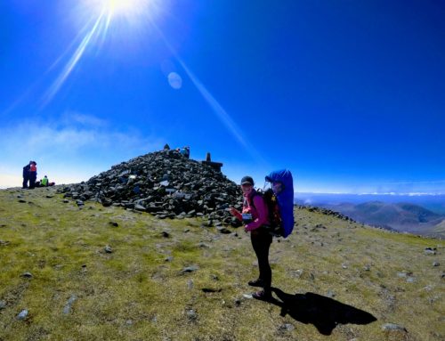
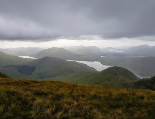
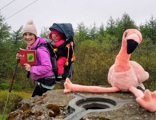
We reached the top of the mountain in around 30 minutes at a very leisurely pace. The peak of this mountain is very accessible and a great County high point to start doing the challenge. From the top of Slieve Gullion, we could see Ulsters highest mountain, Slieve Donard our next mountain to hike in the afternoon. The Top of Slieve Gullion has 2 concrete high point markers which was the first mountain we have seen like this.

We were really lucky at the top of Slieve Gullion, the skies were clear, the air was warm and the cloud broke just as we reached the summit. The clouds resting in the valley below gave us some amazing views that we all stopped and admired.
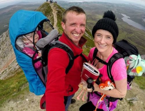
We quickly did the mandatory pictures and video of the high points and started our descent back to our car. We followed the same trail back to the car that we used to ascend the mountain. The descent was very quick but we did stop a couple of times to chat to locals, who all loved Ourlittlehiker.


Our Thoughts on Slieve Gullion Hike
Initially, when we had to drive around the ring of Gullion to get to the carpark to climb the mountain, we were a little disheartened as we had a tight timeframe because we were probably trying to squeeze in too many county high points but this is a county high point that deserves more time to explore.
We loved Slieve Gullion, the path was easy to identify and follow, there were no navigation skills needed here. The footpath surface was very well maintained with gravel in most places and nice rocks to climb on slightly more tricky parts. The climb from the carpark to the high point is very easy and it provides a great viewing platform to look over County Armagh.
If you ever find yourself driving from Dublin to Belfast this is a great little hike to stretch the legs on.
What County High Point next
From Slieve Gullion, we drove to Slieve Donard which took us about 45 minutes. We felt very good after climbing Slive Gullion and the fog had started to clear in all parts of the valley, so hopefully, we could get good views from the top of Slieve Donard.