


About Mweelrea Mountain
Mweelrea is the highest point in Mayo and the province of Connaught, sitting at an elevation of 814m. At the top of Mweelrea, there are magnificent views of Killary Ford, Ireland’s only Fjord and a glacier valley, Doolough Pass. Not to mention the amazing views of the 12 ben mountains and numerous others.
How long does it take to hike Mweelrea
We left our car at 8:30am and arrived at the summit at 10:30- It took us 2 hours to ascend the mountain
We left the summit of Mweelrea at 10:45 and reached our car again at 11:45- It took us 1 hour to descend Mweelrea.
It took us 3 hours 15 minutes to hike Mweelrea this also included breaks and one or 2 small detours.

Where to start hiking Mweelrea Mayo Highest Moutain
We decided to hike Mweelrea from the west side of the mountain. We drove the road from Louisburgh to Silverstrand beach and about 1km from the beach there is a cul de sac road leading up a farmers lane, we parked our car here to start the walk up to Mweelrea. There should be room for 4-5 cars here easily. The time we walked Mweelrea we met no one else, we can only assume there doesn’t be many hiking this mountain.


Hiking Mweelrea from Silverstrand side
The hike starts by walking up a lane for about 300 meters with a farm to our left until we come to a gate. We cross the gate onto boggy land, which is reasonably flat at the start but we can see the summit of Mweelrea in front of us and know this is going to burn the legs off us.


Initially, we start walking straight to the flat section of the mountain because from there we go up the side of Mweelrea to reach the summit.
We soon find a slightly worn trail in the bog but it starts to veer off to the side. We continue walking straight up the hill toward the shoulder of the mountain but the boggy ground conditions are making walking difficult. We look at the Viewranger app and see that other people have walked over toward the stream and then walk up the side of the stream.


We walk over toward the stream, while also walking uphill. This method proves to be a lot easier with better ground conditions and even something that looks slightly like a path.
We eventually start getting close to the shoulder ridge of the mountain but walk into a valley. We foolishly walk too far up the valley and when we reach the shoulder we realise that we now have to descend back down and start walking back up the correct side of Mweelrea.


Mweelrea Ridge walk
After we reach this side of the mountain, there are no more boggy ground conditions, so walking feels easier. The mountain becomes much steeper here but with the solid ground, we seem to make much more progress and really start enjoying the hike from here.
Rising the side of the mountain we see reddish spray paint marking stones on the trail, we can only assume this is to signify the trail in poor conditions. Slightly further up we come across piles of stones in a line, we follow these until we reach the edge of Mweelrea and are greeted with a cliff edge.


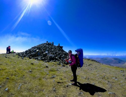
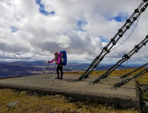
We walk up along the side of Mweelrea cliff but we cannot stop looking at the amazing views along the Atlantic Ocean to one side and the 12 Bens to another. This mountain is surprisingly beautiful. At the top of Mweelrea, we were greeted with a pile of stones which signified another mountain ticked off the highest points in Ireland list for us.


Must see, while hiking Mweelrea Mayos highest point
We are not really beach people but Silver strand beach is crazy beautiful and one of the best beaches we have been on. What’s even better about this beach? No one was on the beach when we were there, no crowds, pure peace and quiet. This is truly a hidden gem.
Croagh Patrick
Croagh Patrick is possibly County Mayos most famous mountain. We have hiked Croagh Patrick numerous times before but it is a quite crowded mountain but it’s always rewarding. Croagh Patrick is 54km away and worth a hike if time permits.

Ben Baun
If you want another hike, try Ben Baun, Galway highest point. It is a 1-hour drive to Ben Baun but when we went hiking it, we couldn’t cross the stream at the start because of all the rain the night before but it is worth considering when you are in the area.
