


Kippure Hike
Kippure Mountain is the highest point in County Dublin. Dublin is the capital city of Ireland and is a neighbouring county to Wicklow, the county with the highest mountain outside of County Kerry. Kippure mountain is 40 km out of the city and can only be reached by car. Kippure is the 73rd highest mountain in Ireland.
We have driven past/near Kippure numerous times and never attempted to hike it, mainly due to weather conditions. When we hiked Cupidstown (County Kildare highest point) the next natural high point to hike should be Kippure, as it’s only a 40-minute drive away. We drove straight past the crossroads that lead to Kippure car park not realising it was so close but we only ever hike up the mountains if the weather conditions and forecast are showing good conditions.

We obviously should have researched Kippure mountain a little bit better, because there is an access road to the top of the mountain, so every time we drove past this mountain we probably could have ticked it off the list much sooner. But if your attempting to hike the 32 Peaks of Ireland, one thing becomes evident very quickly, the level of driving required to complete the challenge is massive.
Getting to Kippure Mountain- Co Dublin’s highest point
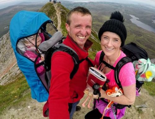
Like most Sunday mornings over the last 3 months, while completing the 32 peaks challenge, we rose from our beds early to hike Kippure mountain but thankfully we could have a slight sleep in, as County Dublin’s highest point was only 1 hour and 30 minutes drive away from our house. We reached Kippure mountain at 10 am and already the car parking space was becoming limited. This amazed us as the weather conditions were not the best, it was overcast with a strong breeze, we knew when we reached the top that the “strong breeze” would feel like a hurricane on the top, so we put on all our windbreakers. We saw some families starting to hike up the mountain in shorts and tee-shirts when we were dressed in 3 layers of clothes each.
Kippure Moutain is situated on the “Old Military Road” off the Sally gap crossroads. If you put Kippure Tv Mast into Google maps it will bring you straight to the car park. The drive up to Kippure Mountain is amazing, we drove home past the Guinness Lake and down into Glendalough. Both these sights are worth exploring on their own, simply amazing.
Hiking Kippure Mountain
The route we chose to reach the summit of Kippure is less of a hike and more of a walk but I did see other people walking in between the heather. We were not in the mood for walking in more heather as every high point is filled with it at the minute. We chose to walk up the road to the top of Kippure.
The hike to Kippure starts at the yellow and black barrier at the car park and you can basically see the whole route that you are about to walk in front of you from here.

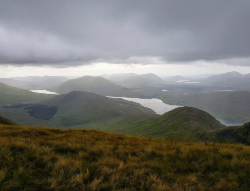
Just as we started our hike the weather started to improve slightly and we could start getting views of other mountains around us. After about 20 minutes of walking, we could see the Sugarloaf mountain in Kilmacanogue.


The hike up along the road was longer than we expected and the views only really improved when we reached the corner close to the end of the road. The road started to sweep around the side of the hill which gave us views down into the valley above the Sally Gap. We could also see the great engineering feat that’s is turlough hill, which was built in 1974. My Dad still talks about this place, as he worked in the tunnels as a young man. The ESB pump water up into the top lake during the night and release it down into the lower lake during the day when there is a large demand for electricity.


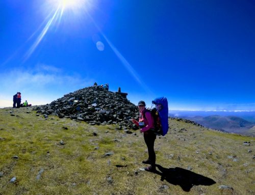
The Top of Kippure Mountain- Dublin’s Highest Point
As we reached the entrance to the TV mast, we could see 2 concrete gate posts, the concrete looks like it has taken a serious beating throughout the years from the weather, as it is crumbling away. The Tv mast is massive in size and the fence surrounding it is very ugly. We skirted around to the rear corner of the Tv mast to find the county high point.

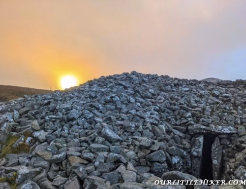
Amazingly enough, for such an easily accessible County High Point the centre section of the Ordnance Survey marker was still in the top of the post. Only a handful of the CHP’s has these and we didn’t expect Kippure to still have one.


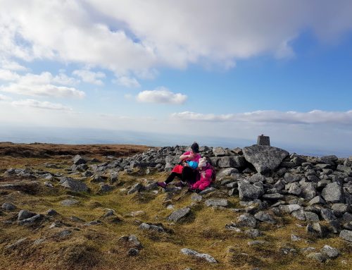
At this point, the wind was very strong and we took shelter to the side of the mast to give our wind-stricken faces a break from the cold air. We sat down on the rocks looking over the Dublin sea. The views on Kippure mountain in late spring are pretty amazing, the whole mountain range is filled with an array of red and green foliage.

Map of Kippure Hike
Our Thoughts on Kippure Mountain–County Dublin’s Highest point
We used this mountain as a rest day on the 32 peak challenge, as it was nice and close and essentially just a road walk. The walk up to Kippure summit is straightforward enough, as we just followed the road to the summit. The views near the top of the walk are nice, as we could see most of the Wicklow mountains from the top of the Dublin high point.
Kippure mountain is a perfect Sunday stroll and is a great rest day if you are completing the 32 peak challenge but the hike to the summit is reasonably dull. When you reach the bottom of the mountain you will be happy to get into your car and go home.
It took us 3 hours to reach the summit and descend Kippure mountain.
Allow time to explore nearby tourist attractions, as the surrounding areas are filled with amazing sights such as Glendalough round tower and the Guinness Lake. If you have enough time you could walk the Spink loop in Glendalough but allow 2 hours to do this hike.