
About the Galtees- Limerick and Tipperary highest points
Galtymore and Galtybeg are the highest points in County Limerick and Tipperary. Galtymore sits at an altitude of 917.8m and Galtybeg sits at 799.2m high. We packed all our hiking bags Friday evening after we got home from work, as we knew we would have an early start on Saturday morning if we wanted to achieve our plans to Climb the 2 high points.
Our Journey to the Galtees
We left home at 6:00 am as it was a 2-hour 15-minute drive to the Galtee mountains from our house. We arrived at the Galtee mountain carpark at 8:30 am, slightly later than we had hoped but we had a few stops on the way down the road. While researching this route many people seemed to walk the Galtee’s from the other side of the mountain or they do a looped route but we wanted to summit the 2 high points and then also summit Knockmealdown in Waterford too.


When we got to the carpark there was only 1 other car there but there seemed to be enough parking spots for 15-20 cars. Our guidebook says to follow the tarmac lane up the hill but while researching online we found that many other people went through the wooded area to the right. We walked up the tarmac lane passing many rural houses along the way. There is no parking up this lane so DO NOT drive up here as you will have to return back down to the carpark.


Starting our Hike up Galtymore and Galtybeg and Mountains
It was such a lovely quiet lane to walk on, we even met a local farmer that gave us advise on the route to take up the mountain. We got fantastic views of the mountains on our right-hand side and we were surrounded by fields of sheep to the left side. It was one of the hottest days we had this year, so it was so nice to feel the heat on our faces. This section of small rural roadway reminded us of the Kerry Camino.

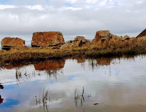
Pointing out the two beautiful mountains we were about to climb.
After 30 minutes the road turns 90 degrees and the road climbs towards a small rural bungalow on the RHS of the road,then stops with a gate to a farm on the left and a gate on the right leading into a small wooded area and then into a boggy field (full of very nosey sheep).


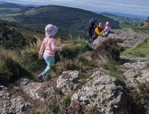
Cross over the metal gate and walk into the field, there is a fence on your LHS follow the line of the fence up to the corner. The ground here is extremely boggy so try to walk on the higher section in the middle to keep out of the stagnant water. The sheep here were extremely nosey and basically followed us halfway up the mountain and were virtually on our heals. Ourlittlehiker absolutely loved the sheep and she was busy pointing, waving and baaing at them. It was so cute to watch and it was a welcomed distraction from the climb ahead.


After the corner of the fence, walk in the same line as the fence which should aim for the passing between Galtymore and Galtybeg. The below image shows the route that we took after leaving the wooded area. We aimed for the low point between the two mountains until we reached the lake. we kept left of the lake.

We crossed many small streams while walking up to the lake. The route is reasonably straightforward up to the lake and not too hard. After we reached the lake we stopped and sat on an old broken stone wall and had a little picnic and changed Ourlittlehiker into her warm hiking overalls and put the wind cover on as we knew it will start to get colder as we reach the summit.


Breastfeeding in the mountains.
The angle of the hill increased significantly and it felt like we were walking on a 45-degree pitch in places. We aimed for the middle of the Galtybeg as our guidebook said there were cliffs to the left after the lake. When we reached the same height as the passing between Galtymore and Galtybeg we started walking over toward this area as it is easier to walk up Galtybeg from this side of the mountain.
While on the saddle Galtymore was on our right and Galtybeg was on our left.
Galtybeg sheltered us massively from the wind so when we reached the low section of the 2 mountains we immediately felt a windchill, this didn’t affect Ourlittlehiker as she was fast asleep in the kids comfort 3 hiking bag. We walked to the top of Galtybeg fairly easily from the col, we followed the trail through the peat. Care should be taken here as the peat is very boggy after the winter we had (we nearly lost our boots a few times).

Galybeg County High Point
There is no high point marker on the top of Galtybeg, so we just walked along the top of the ridge until we started descending again on the other side, we then turned around and started walking toward Galtymore. The views on Galtybeg were amazing but when you look over at Galtymore our focus quickly shifted to climb the higher mountain.
It was a very easy descent back down to the col between the 2 mountains. When we reached the bottom of the Galtybeg we followed the trail up the edge of Galtymore, it was very nice to have a good firm trail to follow for a few minutes.
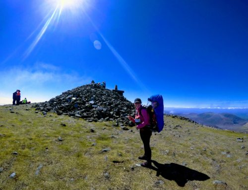
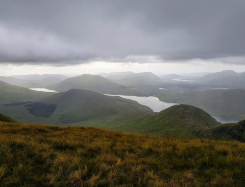
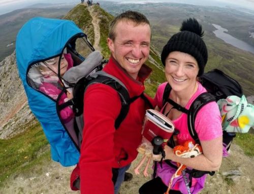
The trail eventually disappears and we start walking up toward the high point but keeping away from the right-hand side as there is a large cliff edge there. It is a nice walk up Galtymore that is not too long after leaving the path. We were really lucky with the weather, as we reached the top of Galtymore we seemed to get a really strong blast of heat, so we could spend a little bit longer on the summit instead of rushing off to keep out of the wind. The summit of Galtymore provides an unbelievable panoramic view of Tipperary and Limerick. On the top, there is an old concrete wall, the Trig point and a white cross.


We descended from our summit by going down the way we came up, a tip with going downhill is to sometimes walk in zig-zags and to use hiking poles. We had a small picnic halfway down which was lovely as we got to sit back and take in the amazing scenery. The sun was shining with a slight warm breeze. Before we had Ourlittlehiker we would never really stop or take breaks but now by doing so, it makes the hikes more special. As one of my favourite quotes says;
”Memories made in the mountains stay in our hearts forever”
 You got to love pulling grass and letting it fly in the wind
 Ourlittlehiker loves sheep
How good was Galtymore and Galtybeg hike?
Overall this was a spectacular hike. A great mixture of small old quite country roads used by friendly farmers that will more than likely stop for a quick chat. It’s filled with extremely green farmland over-friendly sheep that are very vocal and interested in strangers. The hike up the side of Galtybeg gives stunning views of the surrounding counties and the cliffs to the side of Galtymore. You will need loads of energy to keep climbing up the side of Galtybeg but the views from the top are 100% worth the climb.
The Galtee mountains gave us a stunning hike and we highly recommend it to everyone looking for an adventure.
Our Tips for hiking in the Galtee Mountains:
- Go early to get a parking space and to have extra daylight on the mountain
- Bring hiking poles
- Bring a compass and maps
- Gaiters come in handy as some areas are boggy
- Have Good supporting ankle hiking boots especially for going downhill
- Check the weather forecast before going, you would want a fine clear day
- On a windy day make sure to take extra care and stay away from any cliff edges
- Bring your Guide Book as it tells you exactly where to go
- Bring lots of water and snacks, spare clothes, 1st aid kit etc
- Tell someone where you are going and what time you expect to finish it,
- Have fun and stop every so often to enjoy the mountain air and beautiful views.