

The Knockmealdown mountains are located on the County Tipperary and County Waterford borders. Knockmealdown Mountain is in County Waterford and is the County High Point (CHP) of Waterford, Knockmealdown is 794m high.
The route we intended to walk up to the top of Knockmealdown is a basic straight up and down and should be done within 3 hours with good weather conditions permitting. There is also a loop walk that starts at the higher carpark and walks up to sugar loaf hill and then over to Knockmealdown.
Getting to Knockmealdown
Waterford’s highest point is situated on the Vee road. We chose to walk Knockmealdown from the lower carpark but there is also a higher carpark beside the Shepard huts that seems to always have a good crowd of cars in it.
Hiking Knockmealdown Mountain
The hike to the top of Knockmealdown starts at the carpark on the side of the road. As we decided to ascent Knockmealdown first, we parked our car at the lower carpark, right underneath the mountain. The road is busy for a small country road but if you pay attention there should be no problem. After leaving the carpark we walk over a small bridge with a river running underneath.


Just at the Y of the two roads, a muddy track is worn into the bank beside the road sign. Climb up the bank toward the Knockmealdown mountain and start walking up toward the peak. When we walked into this area we struggled to pick out any real walking trails but our guidebook said to aim for Knockmealdown peak.

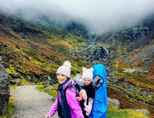
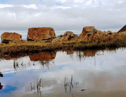
The ground at the start of the hike is boggy and full with small streams cutting through wild heather, so it is not the easiest to navigate through. Five minutes into the hike we had to navigate our way through waist height green bushes, but Ourlittlehiker loved all the hustle and bustle of the leaves hitting her rucksack.

After we hiked through the bushes the ground started to rise up toward the mountain pretty quickly. The heather was pretty thick in this section and we felt we had to raise our feet pretty high to clear the wild heather in sections. Sometimes we found it easier to find a small stream and follow it up the mountain instead of walking through the heather (thank god for waterproof boots).


After about 30 minutes of hiking, we turned around and realised we were halfway up the mountain without much effort or strain. The angle of the mountain did start to increase a bit more from here though, but thankfully the heather seemed to be very patchy from here on up the mountain and we could pick clear routes easier.

After hiking for about 1 hour we reached what we assumed was the top but unfortunately, it was a false peak. We (Semi) knew it was too soon for the top but we let our imagination run riot but when we looked to our left we could see that we were not as high as the other mountains so we couldn’t be a the top so soon.


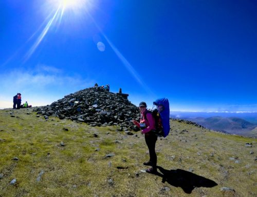
The rest of the hike to the top of Knockmealdow was very easy, as the heather virtually disappeared near the top of the mountain. When we reached the summit of the mountain we were greeted with an amazing view of Waterford and Tipperary, we could even see the Galtee mountains that we climbed the previous weekend.


This is our first county high point that the weather allowed us to take Ourlittlehiker out of the bag to stretch her legs. The top of Knockmeadown is reasonably flat but the opposite edge of the mountain has a cliff, we obviously kept very far away from this. The views from the top were outstanding and we had a small picnic and enjoyed the views.
Knockmealdown to Sugar loaf Hill

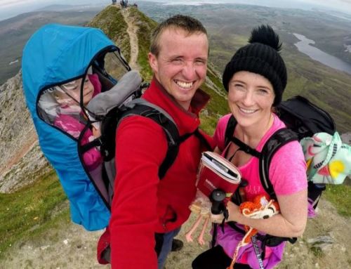
We didn’t intend to walk the loop around sugarloaf hill but when we reached the top and we knew if we descended the way we came we would be back in the car within an hour and we still felt very fresh, so we were eager to get a longer walk in. The walking route over to Sugarloaf hill seems to follow an old wall and the route looked amazing, we had to walk it. As we don’t know when we would be back here again.
 The little wall in the above picture leads the whole way to Sugarloaf Hill. The walk from Knockmealdown to Sugarloaf Hill took us 45 minutes and it was a very gentle descent to the base of Sugarloaf Hill, which sits at a height of 662.7m high. We passed lots of sheep that were not fazed by us walking but Ourlittlehiker did her best to let everyone know there were sheep nearby (everytime she sees a sheep she shouts as loud as she can ‘SHEEEEEEPP‘), we love it and have a great little laugh every time she does it.
Coming down from Knockmealdowns high point, we could see Sugarloaf hill and it looked like we had another steep climb ahead of us again but when we reached the base of Sugarloaf hill, the climb to the top was not too bad and we did it in 10 minutes. The climb to the top is very rocky in places but we took a few detours around these sections and there even seemed to be paths worn into the hill to avoid them.

When we reached the top it was very crowded and Ourlittlehiker was fast asleep at this stage so we decided to continue walking back down toward the carpark without stopping at the top. The route back down to the carpark is a 90-degree turn to the left side from the direction we just came from. The route down from the sugar loaf hill is very easy to find but very steep in places, the walking sticks are essential here.


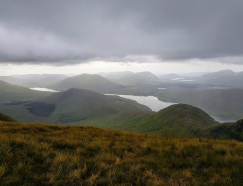
Halfway down the descent, we got a glimpse of a lovely lake. Even though we were descending the views still remained beautiful, we stopped many times to just appreciate the amazing landscape.

We descended the whole mountain and Ourlittlehiker was asleep from the base of sugar loaf hill to the top of it and back down the other side until we reached the road/carpark. Mountain rescue were training in the carpark and they had rescue dogs with them and one barked, she instantly heard a dog and shouted to tell it to ‘get out’ :) .

Walking the Road from Sugarloaf hill
We originally only wanted to walk up and straight back to the car and to not do the loop walk because there was a large road section. As we walked the loop around the mountain we now had to walk the road section but the thankfully all the road from the top carpark was downhill.


We originally didn’t want to do the loop walk because we wanted to avoid walking the road section. The road back to the car took us 25 minutes to walk and all the cars slowed down and provided enough room that we always felt safe. We even saw more sheep, which kept Ourlittlehiker very happy. The road section gave us the opportunity to stretch the legs after a hard descent on the knees.
When we reached the car we had a lovely picnic at the side of our car.
The verdict on Knockmealdown.
Hiking Knockmealdown mountain for the County High point, the straight up and back route is very easy but we recommend if the weather is permitting, you should to try to do the loop walk as it is well worth the effort.
Knockmealdown is one of the easier walks but it is quite high so please give it the respect that it needs and if the weather starts turning bad consider turning around as there are large cliffs to the side of this mountain.
The only negative of the loop walk is the road section, although saying that there are only a few bends and there was lovely Huts to see and the statue of the Holy Virgin Mary. Overall be mindful of traffic and stand in when you see and hear the cars etc.